

HOLBROOKBASIN PROJECT
The Holbrook Basin project is located 7 miles east of Holbrook, Arizona. The project sits atop a large salt basin that is known as the Holbrook Salt Basin. In the 1960’s and 1970’s Arkla Exploration Company and Duval Corporation drilled more than 100 holes exploring for potash in the Holbrook Basin. Arkla and Duval reported the presence of the potassium minerals sylvite (KCl), carnallite (KMgCl3), and polyhalite (K2Ca2Mg(SO4)4*2H2O). In August 2008 the Arizona Geological Survey published an open file report (OFR 08-07), based on its review of the historic drilling data, which suggested the potential for further potash exploration in the Holbrook Basin.
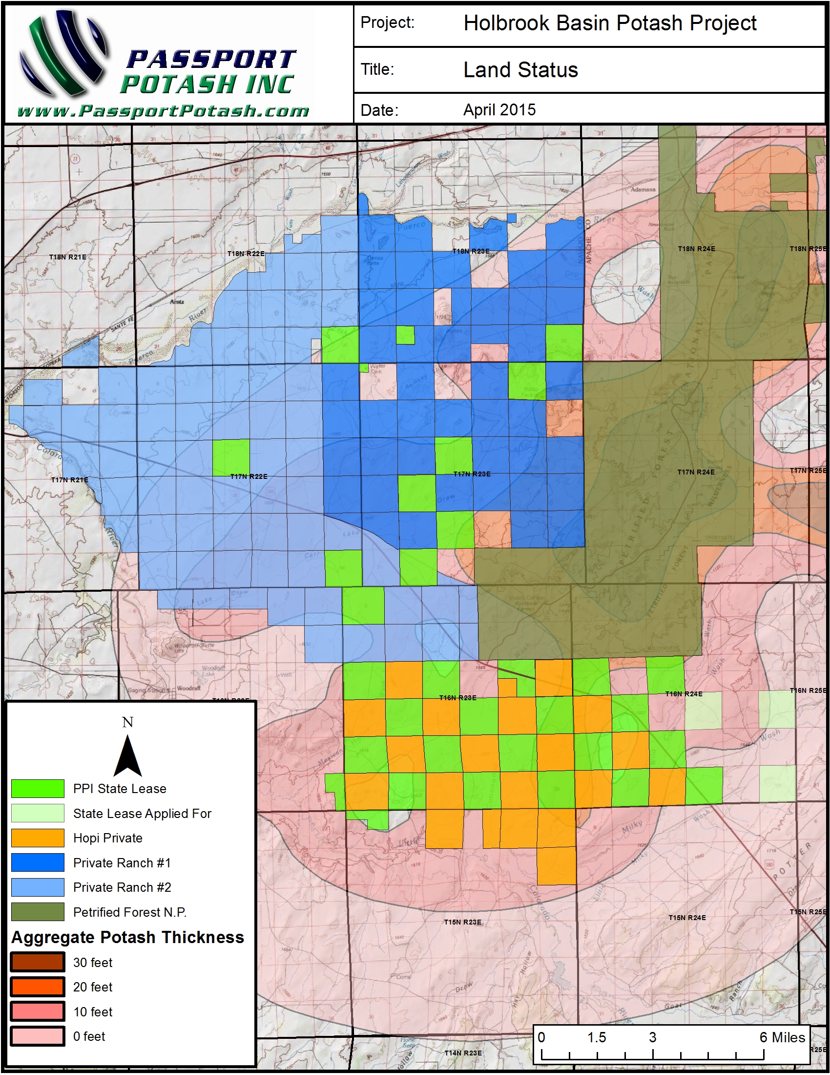
Project Holdings
The AZGS report shows the potash zone in the Holbrook Basin covering approximately 600 square miles. Passport has acquired a strategic position in the Holbrook Basin with its landholdings. In addition to its own landholdings,Passport has also entered into a joint agreement with the Hopi Tribe to work towards developing about 13,000 acres of contiguous privately held Hopi land.
Infrastructure
The proximity to key infrastructure adds great potential to the Holbrook Basin Project. The project is situated near rail, interstate, and power for utilities. The BNSF rail yard is located in Holbrook less the 7 miles away, with the rail line running along Passport’s land holdings. Interstate 40, formerly known as Route 66, runs adjacent to the project and is a major artery connecting California with the rest of the United States. Power is readily available as a major power generation station, the Coronado facility, is located within 25 miles.
Current Passport Program
An independent Preliminary Economic Assessment (“PEA”) was prepared by ERCOSPLAN, a consulting and engineering firm specialized in the potash and salt industry, which encompasses the combined Passport and Hopi properties. The PEA was prepared based on historical drill hole data, data gathered from 52 new holes drilled on the combined properties since 2009, and 100 line miles of 2D seismic survey. The report identified a combined measured mineral resource of 34.77 million tonnes at an average measured KCl grade of 14.38%, and a combined indicated mineral resource of 363.17 million tonnes at an average KCl grade of 14.68%.
The Company is currently working on pre-feasibility and feasibility studies.